Texas Lakes and Rivers
Texas lakes and rivers go together. Such a huge state as Texas would be expected to have many lakes and rivers. Don't you think?
The U.S. Geological Survey has documented 11,247 rivers and streams in Texas. 14 of them can be considered major rivers. Within the state, their length totals approximately 80,000 miles. If imagine putting them end to end.1
Instead of this introduction with a Texas river map, get right to where you select any of your interest in the:
Within these Texas rivers, there've been created 196 important lakes.6
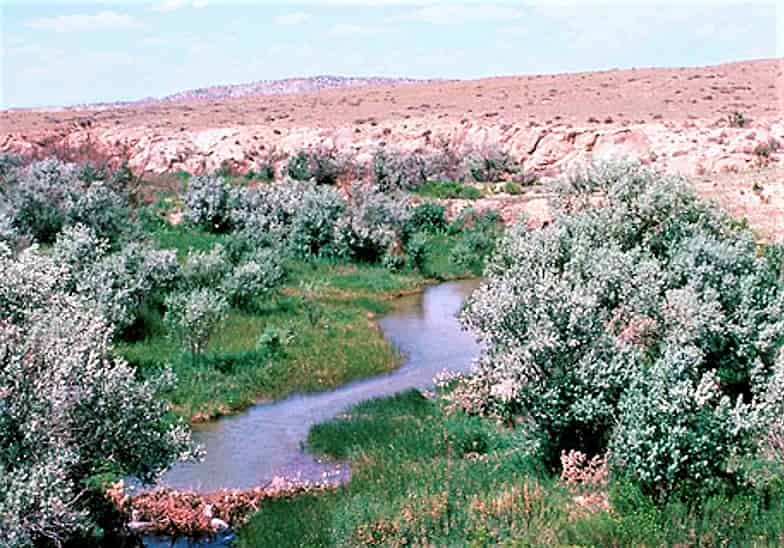
 Dusk at a Texas Lake
With growing population after westward immigration of the 1800s, floods were sometimes a problem. Construction of reservoirs began for flood control. Later when drought set in, Texas recognized their secondary benefit was saved water resources.6
With purchases made via links on our site, we may earn a small commission at no extra cost to you. Details at our Advertising Policy.
Some streams feeding into rivers become intermittent. Some river flows are inconsistent. Reservoirs have been important creations. Doing just as their name says: reserving the flow of river and stream water.
Impounding waters via dams into Texas man-made lakes. Similar to all the U.S., providing these benefits for Texans:

- Help prevent rivers & streams from causing floods.
- Supplying drinking water
- Supplying waters for farming & business use
- Provide the additional benefit of recreation
- That's the general benefit we, every-day citizens, all love!
Any major Texas reservoir holds at least 5000 surface acres of water. 188 reservoirs are designated for water supply benefits.6 Let's take trips along Texas lakes and rivers, watching their connecting flows. Here's your Texas Lakes and Rivers map, for an overview:

Table of Contents for
Texas Lakes and Rivers
Black Friday* is Here!

*Minimum 30% discount available on new accommodation bookings at participating properties indicated by the “Black Friday Deals” badge on the search results and room selection pages. Bookings must be made before 09:00 am CET on 01/12/22 for stays with check-in from 17/11/22 and check-out on or before 31/12/23. Discount applies to the cost of room only (excluding any additional fees or taxes). If you make any changes to your booking you may lose your discount and be liable for the full amount. Discount cannot be used in conjunction with any other promotions. Room rates labelled “Partner Offer” are excluded from this promotion. This offer is provided by the participating property and subject to availability.
Review some of the major Texas lakes and rivers, and some of the upstream sources & tributaries supporting them. Click on those you're mainly interested in. Or to browse them all, just keep scrolling on down!
SOME MAN-MADE TEXAS LAKES
SEE YOUR TEXAS RAINY
SABINE RIVER
Journeying for miles as a shared river. How? It naturally forms much of the Texas border with Louisiana.
It's the farthest Southeastern Texas lake and river we generally concern ourselves with here. And for our site overall, as well, our most southeastern lake and river.
Sabine Lake - Its outlet at the Gulf of Mexico, technically an estuary. The Sabine has strong flow along its 555 meandering miles. In fact, total flow into Sabine Lake is more than any other Texas river. Because all its watershed areas get plenty of rainfall.2
Follow it from Sabine Lake in a generally North-Northwest trajectory, you'll pass parks, wildlife refuges, boating ramps, and of course Texas lakes & river-side campsites. Plus many time-formed secondary lakes, like oxbow, fluvial, & anthropogenic lakes.

The first Texas reservoir you'll encounter is Toledo Bend Reservoir, sharing shores with Louisiana. Texas's western shore has plenty to offer:

Most of that lakeshore is encompassed in Sabine National Forest
- With many places for camping, boating, fishing, swimming & hiking.
You can stay economically On the Lake>
- With a fabulous view & a private beach.
- AC, free parking, fishing on-site.
Or there's more options:

You could stay lakeside, awhile more, if you wanted to cross over Pendleton Bridge. You could find some East-side Stays that maybe you'd prefer.
")
Or move along upriver!
That ends the shared Louisiana border. Go along to multiple boating areas, like Yellow Dog Boat Launch & McFadden Landing. If you get to Longview, you can try Riverview RV park, with pretty good reviews.
At Hawkins, SW of State Hwy.80, the Sabine River borders Little Sandy National Wildlife Refuge. There try out the lakes & ponds for fishing.
- The Western refuge area becomes Old Sabine Bottom Wildlife Management Area.
- Just north of its boundary is a major tributary: Lake Fork Creek joins Sabine River.
- This major creek from north-northwest has connected lakes & tributaries.
- In particular its namesake, the reservoir: Lake Fork.

The Sabine River meanders along southeast of Mineola. To border Mineola Nature Preserve. With 4 fishing ponds.
And West of W.Mineola there's even more, on Hwy.80's Southern side. Some may be private lakes with homes for sale or rentals:
Butler Lake is sourced from intersecting flows with the Sabine
Schrivnor Lake is an oxbow south of Sabine River
Camp Lake is quite small, just west of the Sabine
At Texas Coordinates: 32.673240, -95.572046, Hwy.80 crosses over the Sabine
Soon on the river's SW side is a large oxbow called Neil Lake
This Texas River soon becomes more stream-sized, until further upriver on the east side, see another oxbow called Goose Lake.
Just as the Sabine's banks widen out again, approaching Lake Tawakoni Dam! Which forms a large Texas lake...
LAKE TAWAKONI - This reservoir helps supply water for Dallas.
But easily recreation fun is here at one of the Lake-themed TX state parks.

- They'll direct you to fishing (it's stocked!). Great for catfish, especially.
- And the boating. But watch for submerged trees!
- Located east of Dallas, in Wills Point. 903-560-7123
The Sabine River continues out from Wichita Bay at the far north end, past Stone Point. Its banks soon narrow, meandering through treed flatlands.
Flowing below I-30, west of Exit 96. Soon reaching several Greenville reservoirs, adjacent to the Water Treatment plant. And thereafter dwindling off into its source.
NUECES RIVER
Many pecan trees grow along its banks. That's how it got the name, for "nut" in Spanish. How is the Nueces pronounced? New - Way - Seize.

Headwaters are east of Rocksprings TX.
Nearby Edwards County Hwy. 335, south of Devil's Natural Sinkhole. Supported by nearby Hackleberry Springs.
Another similar arm enters from northeast of Barksdale. From Camp Wood south, flows more reliable. Very nice!
An eastern source enters at Ranger Hollow, after springing from groundwaters south of The Kettle, in desert areas of Real County.
Along its flow, sometimes it dries up. Especially in times of drought. Let's follow it along...


It winds southward. Several campground resorts to try, along Hwy.55.
- Like Wes Cooksey Park & Chalk Bluff River Resort and Park.
Departing that highway, flowing west of Uvalde & Batesville. Then just east of Crystal City through farming areas. But soon starts forming lakes.
West of Winter Haven is Boyton Lake formed from damming river waters.
On a little farther you'll get to Bookout Lake/Reservoir at Presidio Park, a Dimmit County park.
The river's banks sometimes expand & then narrow. You're traveling through beautiful rural areas.
Occasional oxbow lakes adjacent. An unusually large example west of Cotulla is Harris Lake.
Soon there's a wide spillway where winding creeks add flow. Creating Hargus Lake & Guttman Reservoir.
Several more oxbows as it runs below I-35, north of Exit 65 just outside Cotulla. West of the freeway the local KOA has its own lake.
Southeast of town, a small dam creates Cohenour Reservoir.
Further on, through many farms there's Allerkamp Reservoir. Continuing on for many miles of rural land.
Finally reaching a nice County Park, where there's a river paddling trail. With put-in & take out spots. Near George West TX.
Then passing through more populated areas. As Nueces River begins to widen out approaching the largest lake along its path:
LAKE CORPUS CHRISTI - Driving to it, best accessed west of I-35, taking exit 36.

- The State Park is on the Southeast shore.
- A private camping beach park is next to it. People like it, but also complain about it for high rates & rude service.
This Texas river, the Nueces, flows from the lake's Southern end. Soon laps along the border of La Fruta Park. You can fish, picnic or have a nice nature walk there.
Not much further another small riverside park called Labonte Park - Calallen. Short-term camping allowed. Off I-35 exit 16.
Finally the Nueces River flows into Nueces Bay. North of the cental city of Corpus Christi.
The Atascosa & Frio Rivers are primary tributaries.
BRAZOS RIVER
Originally named by Spanish who explored the area, calling it "Los Brazos de Dios" which translates as the arms of God. They had reason to call it that, as they were thirsting for water when coming upon it. However, there are several arms to its flow!7
Native Americans in the area in those times likely referred to it as Tokonohono.7
The total length of the Brazos River is 840 miles, from the confluence of 2 main tributaries begin its waters. It reaches the Gulf of Mexico just South of Freeport.7
The heavily flowing Brazos River has several main tributary arms:
Two Main Forks join, forming the Brazos River's start, with headwaters in Stonewall County:8
- Salt Fork Brazos River - Beginning as a usually dry bed. It's then intermittent before arriving at its confluence with the other major fork

- Double Mountain Fork Brazos River - Sandy bed, with stream-fed waters. Added to by rain, it weakly flows. Despite this, some lakes are along its path.
Clear Fork - The longest tributary. With mostly a sustainable flow, it passes some historic areas of note.
- A notable tributary is Paint Creek, which sources Lake Stamford.
Paluxy River - Also called Paluxy Creek. A smaller tributary. But notable for several reasons, flows in from the West.

North Bosque River - Joining the flow at Waco
Little River - Confluence northwest of Bryan
- San Gabriel River is a major tributary, which gets lengthy flow from Lampasas River, which gets important long-range flow from the Leon River
Yegua Creek - Meaning "mare" in Spanish, its flow is slow. Along its way there are several lakes & fun opportunities for kayaking.
Navasota River - Dams along its course form some Texas man-made lakes.
42 Brazos River Lakes are sourced from this river flow, within its watershed!13 This amazing river, is so important for Texas recreation. It also has heavy water demands from other needs.
So Much To See & Do Along the Flow of The Brazos River!
More Texas Lakes and Rivers
What are other Texas rivers that have created major Texas lakes?
CANADIAN RIVER
Not too long east-west through the Texas Panhandle, but the waters make it to a super lake:
Lake Meredith - Like a surprise, an oasis, that suddenly appears in this flat landscape. Drought really is troublesome for this dry area. Affecting its water levels. But true to Texas spirit, lakeside action lives on.3
And so does the river! Check this out:
RED RIVER
This storied River has headwaters in the Texas panhandle. But moving on from there, it begins sharing the border divide of Texas & Oklahoma. Following all along through many Texas land forms, from pure red-sand desert to grassy woodlands.
It reaches the Northeastern corner of Texas, at Texarkana. That location, as you may tell by the name is where the Red River begins flowing into Arkansas.
But while moving across Texas, the Red River courses through multiple scenic areas for fun, terrific recreation, and nice vacation spots. Check out these examples:
Palo Duro Canyon State Park - the Red River's upstream creek gurgles amidst the parkland. Usually slowly - unless there's some flash flooding! (Be on the watch-out when there are storms coming through.) We loved Our camping trip here, awhile back. Really cool activities, including a historic play.
If you're not into camping, there are great places to stay in Canyon Texas. You can investigate the Red River's headwaters, one of which is Palo Duro Creek. See what the town has to offer, including a museum, parks & their own lake. And a short drive to the state park.
Ranch-home Sleep 5 Near Palo Duro Creek
This Vintage Inn Matches the Budget!
10 Minutes to Palo Duro Cyn SP: Sleep 8
Barndominium In Canyon With Views
Soon the headwaters' stream, called Palo Duro Creek, forms private lakes: Palo Duro Club Lake, Lake Tanglewood & Currie Lake.
It's after this that the stream flows into Palo Duro Canyon.
The area surely is desert, as it babbles out of the park. That's when it's renamed: Prairie Dog Town Fork Red River.
With widened banks & a bit more flow. Crossing the panhandle's southeastern section.
It ends its issue as a purely Texas Red River when it hits the Oklahoma border, northeast of Childress Texas.
The two states share the river, until they begin sharing the huge Lake Texoma.
 Lake Texoma visitors meet up with Coast Guard Crew for Lake tips.
Here you'll discover a wonderful example of a Texas State Park on a Lake.
There's so much more to Discover About the Red River>
TRINITY RIVER

The headwaters' sources are forks in north Texas. Flowing all the way south to outlet at Galveston Bay. As you may notice in the above image, there are four major Northern Forks:
East Fork - rising from areas North of McKinney Texas.
- Along its flow are three significant lakes.
Elm Fork - beginning west of Gainesville Texas.
- Three Texas man-made lakes are created from its waters.
West Fork - with headwaters in the area of Jacksboro TX.
- Three reservoirs are formed along its route.
Clear Fork - shortest major tributary, sourced in farming areas north of Weatherford TX.
- Two primary lakes contain the flow of this fork.
Once the forks have joined, some miles south of Dallas metro-area, there are many miles more to go! Many more Trinity River confluences. The Forks, & plenty more substantial creeks & watercourses. All contributing on its flow southeasterly to its outlet.
So much of this major Texas River that You Can Explore!
COLORADO RIVER

This Texas Colorado River doesn't flow from the Colorado River of Arizona, Utah & Colorado, etc. It's totally inside the borders of Texas, with many important features & tributaries.
It begins in quite dry Texas country. But natural springs pop up around there, getting it started. As it winds its way southeast it forms lakes you may have heard of. And provides tons of recreational opportunities, and many fun vacation stays.
You can follow the course of this major Texas river.
We'll take you On A Tour of it's flow!
PECOS RIVER
Here's a great renowned Texas River from history. Have you heard of Pecos Bill? We had a kid's book for our son that featured him. We read it to him at bedtime when he was little.
Have you ever been to the visitor center featuring Judge Roy Bean? They called him "The Law West of the Pecos."
The Pecos River actually begins north of Pecos, New Mexico, in the mountains at a high elevation. By the time it flows into the Rio Grande River, its elevation is under 1000' - quite a downhill ride!
It gets into Texas from New Mexico within a lake.
A man-made Texas lake, called Red Bluff Reservoir.
When the waters flow from the dam, they ramble through lots of desert & desolate areas of West Texas. The river cannot be considered pristine, unfortunately. It really could use friends.

Much of its use along the way, through desert & canyons, is for mining, gravel pits & some farming needs. It flows near oil wells. Plus some oddities, and unique or notable features.
Then it ends in a reservoir of friendship.
RIDE THE PECOS FLOW
Texas Rain Season
The most important thing affecting Texas lakes and rivers is rainfall. There's no two ways about it.
Texas is varied in its geography & climate features, so Texas Rainfall averages 10"/year in the arid West, to 55"/year in eastern areas.
Rainfall goes somewhere, and it's influenced by factors determining availability. Yearly measurements must consider those for practical analysis.
How Rivers Form
What are the land surface types & interactions that must be considered in river formation?5
Geology - Land formations & local natural interactions
- Soil Type - Rocky, sandy, clay soils, loamy, good top-soil, or subsurface caliche
- Surface slope - Increased degree of slope can mean faster ground flow
- Vegetation - From desert areas to tropic-like lushness & everything in between
Evaporation - Increased water surface area can increase evaporation. But other factors play a role. Like wind, higher temperatures, & sunlight.
Land Use Practices - Relating to human/government decisions, zoning, regulations, laws, etc.
Runoff - Generally determined by the factors of Geology vs. the factors of Land Use Practices. Finalizing totals of impervious cover.
Sometimes Texas rain falls so hard & long, you wonder about flooding. Or the rainfall is a sudden deluge in a particular area, that can lead to flash floods.
The U.S. Geological Survey therefore created a system to send out notifications for your area of interest. They work with stream gauging monitoring equipment that notes when flood levels are being reached in related areas.4
 Stream Gauge Monitoring Station
Do you wonder if the rivers are rising in your area? How will you know?
If these worries are sometimes on your mind, you can select varied options that apply to your situation. Find out How It Works>
Other Suggested Pages For You:
Arizona Rivers - Take This Virtual Trip
Arizona rivers are found in all corners of AZ! From mountains to desert. Is that surprising? We give you notable facts on their routes & their flowing ability.
Things to Do at Lakes - Top Ideas, Tips & Info
Covering things to do at lakes: lots of the ways you can have fun - with the family, on dates, getting exercise, where to go, can you imagine more? We can!
Red River in Texas - Panhandle to TX-OK Border
Red River in Texas has lakes & riverside interests along its course. We take you along its flow to see where it takes you.


See References For Texas Lakes and Rivers>
Some Directional Information on This Page May be sourced from Map data ©Google
If You're Enjoying This - Please Pay it Forward
Send It/Share It

We're From Arizona & We Know Our Southwestern Home
We Love Helping Others Appreciate It Too!
Supporting Local Businesses Throughout the Southwestern USA
Privacy Policy | Terms/Conditions/CC Licenses | Advertising Disclosure | Contact Us
© SWlakesUSA.com: 2021-2022 - A Production of Picture Rocks Networking LLC | All Rights Reserved
As an Amazon Affiliate we earn from qualifying purchases.
WE DO NOT SELL ANY PERSONAL INFORMATION FROM THIS WEBSITE
This site is protected under U.S. and International copyright laws. Do Not Copy - No use is permitted without permission.

