Texas Colorado River
Yes, Texas Colorado River. Have you heard of the Colorado River in Texas? Of course, Texas has its very own.
It doesn't connect to the one you've always heard about bordering Arizona, etc. Fully within Texas, it's over 800 miles long & its watershed covers nearly 15% of the state.1,2
With purchases made via links on our site, we may earn a small commission at no extra cost to you. Details at our Advertising Policy.
It has some wonderful sights & activities along its flow. Why not follow along with us to see what it offers. We think you can have some fun along its lengthy course!
As the Texas Colorado River Flows
The Highland Lakes & those in Austin are important reservoirs created from its waters. But there are even more. Yet, let's start at the beginning - at its source.
Its headwaters rise in northwest Texas, then generally flow southwest. Following this important Texas river, along its course, we'll discover its lakes.

In the spring-fed areas in arid lands southeast of LaMesa TX - that is where waters for Texas's Colorado River are sourced.
- Very well may be dry in the arroyos where it begins.
- Yet mysteriously rain and/or groundwater supply can suddenly get it flowing at the right times.
- Drive north on County Rd.1054/Vealmoore Rd., from its E/W intersection of 1785, to take a look.
- Anything flowing?
- Likely not much, if anything, most of the time.
- And soon the sandbanks expand to what? - - -

An Oasis of Lakes
Lake J.B. Thomas
Lake J.B.Thomas - Is there water? It's a reservoir, but may not be nearly full. Its depth severely changes, depending on conditions. On the other hand, there could be lots of water, and some great fishing too!
From over 250,000 acre/ft. around 1960 to 63,471 acre/ft. by mid 2022. In 2014 it was nearly empty.3 Access from Bull Creek Park.
The river outlets at the dam on the east.
- These upper flows of the Texas Colorado River are now fairly steady. Wandering through rural farming areas.
- Sulphur Creek converges with Deep Creek, as two strong tributaries before the Deep's confluence with the Colorado northeast of the Junction of County roads 212/4109.
- Flowing generally southward, the Colorado River passes a large oxbow lake. Then gurgles under I-20 east of Exit 213 & Colorado City.
-
An important confluence with Champion Creek comes up soon on the east side. Another, Beals Creek comes in from the west. And then...
_______________________
E.V. SPENCE RESERVOIR
Northeast of Edith, its waters begin backing up into another Texas Lake...
E.V. Spence Reservoir - A very rural, quiet area.
There are 4 public access points for camping, fishing & picnicking.
- Though the photo looks like it's pretty full - How Much Water Does It Have Now?

This Texas Colorado River reservoir's dam outlets waters to flow south of Robert Lee TX.
Flowing south of Bronte, winding generally southeasterly.
It nears a private oxbow called Lloyd Lake.
Then flows south of Ballinger crossing state highways 67 & 83. Southeast of town is a major confluence: Elm Creek. Not long after Mustang Creek converges.
Soon its banks expand as more lake shores begin...
O.H. Ivie Lake
O.H.Ivie Lake - East of Paint Rock, the landscape is still mighty rural.
A marina's on the South side, Padgett Red Area on the North side.
The Concho River tributary flows into the southwest arm. The dam is on the southeastern arm, where the Colorado outlet flows on.

And on & on, now tracking west to east.
Flowing just north of the Geographical Center of Texas!
Courses along by multiple adjacent oxbow lakes.
Wilbarger Creek is the next significant tributary & then the Pecan Bayou.
Until northeast of San Saba town, is the San Saba River.
- An important tributary, it merges into Texas's Colorado River from the west.
South of Bend TX, the Colorado borders Colorado Bend State Park. Then winding its way a bit more south til forming another lake...
Highland Lakes of Texas
Lake Buchanan
Lake Buchanan - About midway between Burnett & Llano.
- Texas's Colorado River is now flowing into Texas Hill Country.
- You'll have a choice of several nice parks & places to stay lakeside.

The south side's dam flows the Colorado River, here in Texas, on out. But soon enters more lake waters...
___________________________
INKS LAKE
Inks Lake - Very picturesque & well accessed via the state park. Waters exit at the dam on the Southwest side.
 Stunning Cloudy Day at Inks Lake
Soon the LLano River tributary enters from the west. As the two merge, more waters gather so that downstream there's LBJ Lake...
__________________________
LAKE LYNDON B. JOHNSON
Lake Lyndon B. Johnson - Lots of private access.
But numerous public access parks on its shores can be found. Including McNair Park, Clear Cove, & most Granite Shoals City Parks. Almost everyone loves the peacefulness, sunsets, kayaking & fishing here.
The dam at the River's Authority is at the Southeastern shore, where Texas's Colorado River continues.
 Lake Lyndon B. Johnson with Texas Colorado River Waters
Lake Marble Falls
After some islands & shoals, a couple of bends, the river widens into Lake Marble Falls, with access via Lakeside Park.
Eventually you reach its impound source, Max Starche Dam.
Then the river undulates along, soon gathering further lake waters starting at about Smithwick Texas...

 Starcke Dam Creating Lake Marble Falls
Lake Travis
Lake Travis - Snaking through 2 counties, there's over 270 total shoreline miles. It's nearly 64 miles long.4
Quite popular, with good bass fishing. But there's a great many ways to enjoy it!
- A nice place for kayak/canoe put-in: Narrows Recreation Area.
- You'll never lack for tons of shoreline fun activities & fabulous lakeside places to stay!
- We found a lakeside villa for a Christmas holiday week around 2015 & had a wonderful time.
About midway along is the confluence of the Perdanales River.
Near Pace Bend Park just beyond. Very popular, & large. But a wildly excellent spot. Go early, they close when filled.
Or keep moving along the lake with more access/activities.
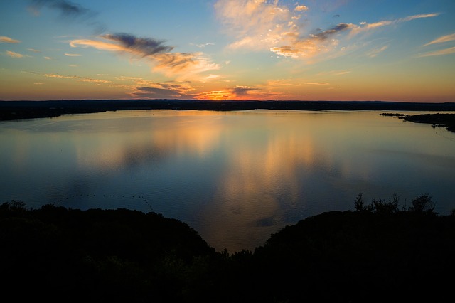 Lake Travis Sunset
Finally you reach the dam amidst heavy suburban areas. The Colorado flows beyond, and soon into...
________________________
LAKE AUSTIN
Lake Austin - Another zig-zaggy lake flow. Impounded by the Tom Miller Dam. Very nice visit, we recommend Commons Ford Ranch.
Soon after comes delightful Red Bud Isle & the City of Austin's other lake...
Lady Bird Lake
Lady Bird Lake - As it winds city-side, you have photographically idyllic views & an ideal walking path. There's also a fabulously scenic boardwalk!
Finally the Longhorn Dam outlets waters back as that Texas Colorado River...
On Its Way to the Bay
Into Austin southeastern suburbs & then more rural vicinities.
Passing beautiful Texas Parks, then reaching eastern Bastrop.
Takes a sharp bend South of LaGrange. Passing under I-10 east of Exit 696.
And continues southward, until...
 Final Flow of the Texas Colorado River
Finally nearing saltwater west of Matagorda. Where it empties into Matagorda Bay.
Other Suggested Pages For You:
Arizona Monsoon Season - What, When & How?
Arizona monsoon season is really loved & looked forward to by most local Arizona people. Our videos, pics & words help explain why. We love our AZ weather!
Best Texas Lakes - May Be Your Tops!
Best Texas lakes are filled with so much fun they'll literally knock your socks off! Playing in the water: fishing, swimming, boating, camping. What? Come see!
Utah State Parks With Cabins - Find Your Stay
Utah State Parks with cabins are in all areas of the state. Stay in any of them, or one of the unique alternates. Have fun while seeing these wonderful places.


See References For Texas Colorado River>
Some Directional Information on This Page May be sourced from Map data ©Google
If You're Enjoying This - Please Pay it Forward
Send It/Share It

We're From Arizona & We Know Our Southwestern Home
We Love Helping Others Appreciate It Too!
Supporting Local Businesses Throughout the Southwestern USA
Privacy Policy | Terms/Conditions/CC Licenses | Advertising Disclosure | Contact Us
© SWlakesUSA.com: 2021-2022 - A Production of Picture Rocks Networking LLC | All Rights Reserved
As an Amazon Affiliate we earn from qualifying purchases.
WE DO NOT SELL ANY PERSONAL INFORMATION FROM THIS WEBSITE
This site is protected under U.S. and International copyright laws. Do Not Copy - No use is permitted without permission.

