Southwest Region Climate
The Southwest Region climate in the United States is often associated with extremes. Extreme high temperatures. Also extreme dryness which means days & weeks on end without rain.
Temperatures in the southwest region average greater than states up North, because there isn't as much water vapor in upper level winds to screen direct sunlight.
Thus many, many more sunny days, without even a cloud in the sky. Nothing up there to dilute the sun's strength.6 It's why our advice is, when outdoors here in the summertime, stay in the shade!

On the other hand, it's an area of contrasts. For instance Phoenix, a little more than an hour north of where we live, can get record high temperatures often enough.
Yet Alamosa Colorado, about 450 direct miles northeast of Phoenix, has recorded record lows. What they have in common: both get little average rain totals.1
With purchases made via links on our site, we may earn a small commission at no extra cost to you. Details at our Advertising Policy.
Additionally, some areas of the Southwest discussed here, because of diverse landscapes and influences from weather systems, sometimes are inundated suddenly with overwhelming rainfall.
Elevation is also a strong general influencer for rainfall in the southwestern region climate.4 Always keep mindful of the contribution to the climate of the Southwestern US by these varying extremes of elevation.
From below sea-level of Death Valley, and a few other areas of California, to the farmlands and marshes of Texas, to the highest peaks of the Rocky Mountains, the Sierra Nevada, and the Mountain Islands of Arizona and New Mexico.
These elevation extremes make the Southwest among the most diverse plant ecosystems in the world.1


A local example is where we live in Tucson Arizona. Located adjacent to the beautiful mountain islands called the Santa Catalinas.
 The Santa Catalina Mountains - They Overlook Tucson AZ
On the hottest days of summer, our backyard may register 105oF.
But take a drive up to the top of Mt. Lemmon in the Catalinas, at over 9000' elevation, the temperature will be in the 70oF range. You'd also note the change in plant-life as the elevation rises.
In winter, there are days it's possible to ski (at the farthest South U.S. mainland ski slope). Then go downhill to take a swim in a local pool, boat at a local lake, or have a picnic or nice day of fishing somewhere in town.
Climate Defined
People sometimes interchange climate with weather. They are related, but they're not the same. Think of it with regards to time.
Weather is what is happening day to day. Will it be sunny? What will today's temperature be?
So you know how to dress for the day. Will it rain, is it raining? Then you'll need your raincoat or umbrella.
It's what they tell you during the daily news, or when you look it up for your plans on the coming weekend.
It can even be changeable, from one hour to the next. Even within minutes.
And the accuracy isn't always right on! I'm sure you've experienced that one, no matter where you live.
 What's the Weather Outlook?
Meaning: weather reflects "conditions of the atmosphere... over a short period of time"3 - which could affect you today, tonight, tomorrow, this weekend.
But Climate: That means collecting weather data over long periods of time, grouping it to analyze a specific area. There are many different climate areas/categories throughout the world.
 Five Earth Zone Interactions Amass Climate Data:
Hydrosphere, Atmosphere, Biosphere of Life
Earth's Soil Layers (Lithosphere) & Perma-frozen Regions (Cryosphere)
- Scientists generally analyze an approximate 30+ year time frame for gathering data regarding an area's climate description.3
- For a specific area, say the Southwest Region's climate in the U.S., or for instance, Nevada's climate.
- They gather rain/snow totals, average temperatures, humidity data, winds, sun vs. overcast, various types of storms, fog, freezing effects like frost. Etc.
- All these measurements, and more, are gathered. Each year they unravel them, evaluating those past 30 years or so, according to averages, figuring out what this tells them about climate.
- If you wanted to know what Oklahoma weather year-round is like, these averages help you get a good idea. Seeing trends in Oklahoma's climate.
- Climate - Meaning: Extended, long-standing portrayal of weather systems in a specified geographical area.
 Continue On For Helpful Planning Tips
According to NASA, Climate Study in the U.S. began with Thomas Jefferson in the late 1700s.
Science climatologists evaluate various climates of the world, by using Koppen-Geiger Climate mapping. Koppen invented the system, which was then updated with input from Geiger.
It began with five basic divisions of climate type keyed with lettering: A)Tropical, B)Dry/Arid, C)Mild/Temperate, D)Continental & E)Polar.
- The system primarily focused on temperature, which affects plant life in an area. Although to some degree aridity is factored in, particularly in the driest regions.7
- Then subdivided under each category, according to more specific criteria.
- By graphing these climactic regions, and following trends over the years, climate changes can be observed.7
- This data can give insight into things happening, such as the trend in Utah environmental quality.
- It was again updated by in 1966 by G.T.Trewartha who corrected some flaws he noted.
- For example, cities like Brisbane Australia were in the same climate category as London and New York City. All with obviously different climates, particularly Brisbane.10,11

Some Southwest Region Climate Facts
The states in our Southwestern Area of discussion for our SWLakesUSA website all have areas common to the typical Southwest Arid region: to generally describe it means year-round warm median temperatures, low average annual precipitation, and usually clear skies.
However each state in this area has its own specificities, depending on elevations, proximity to large bodies of water, and the flow trends of upper atmospheric currents.
This gives each state its own unique southwest region climate characteristics.
To view each state individually is to recognize their own specific climate differences, yet their common features.

Texas - Such a huge state reflects that in its climate. The western arid deserts contrast with the humid, subtropical east. Plus the entire coastal areas subject to hurricane season.
Oklahoma - The OK state has a range, the Western section is semi-arid, particularly the panhandle, which is also cold.
- The Gulf of Mexico contributes rainfall to the South & East.
- Its short winter-time has few severely cold days. In most areas, summers are hot, fairly humid.
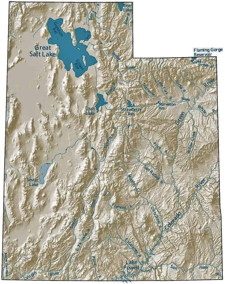
Utah - Its elevation influences the climate, along with distance from Pacific & Gulf water sources.
- The Western mountain ranges influence precipitation, triggering rainfall before reaching the state. Thus except for its own mountains, rain/snow totals trend toward arid. With usually sunny skies.5
Arizona - With mostly Sonoran Desert, some Chihuahuan & Mojave Desert, the climate is warm to hot & dry.
- Amidst the deserts are numerous mountain range Sky Islands which make for an entirely different climate of their own.
- The remaining lands are the high country, with lower average temperatures and variable rainfall.
Colorado - The southern section, western edge, & the eastern third are all more arid climates.
- The Rocky mountains generally are exceptions to the state's aridity.
California - A good portion of the state has a Mediterranean type climate, meaning hot/dry summers, with winter rain.
- Much of Southern California is arid/desert.
- The Sierra Nevada range lining the eastern part of the state avoids most of those categories, but recently suffers drought conditions.
Nevada - Sitting just east of the towering Sierra Nevada, the rainfall dissipates there, & so only averages 9"/year.
- Their mountain ranges get snow.
- Overall mostly sunny days, low humidity, daily extreme range of temps.5
New Mexico - Very similar to Arizona's Climate: arid. Except the average elevation is higher, their desert is strictly Chihuahuan.
- Thus their average temps are somewhat lower.
- The do have Sky Islands. The NW section has Colorado plateau high country effects.

Southwest Region Climate in Winter
People living in colder northern climates like to travel to Southwest region climate areas for a break from their winter. Maybe for a short vacation. Maybe for the entire season.
What is the climate like there? As you can see, from evaluating different states, it does vary from state to state.
But overall, know that in many areas of the Southwest, winter daytime temperatures can hover around 60-70oF. The nighttime temperatures will take a drastic drop as soon as that sun sets. Anywhere from the 50s to below freezing. Depending on the specific area.
Humidity levels are quite dry, even as low as 10%. The low deserts will be warmer overnight, the high deserts much colder.6
States we cover that have subtropical or Mediterranean climates won't have those swings. They'll generally just take a dip of 5 to 10 degrees overnight.
Unless a cold weather front comes down from the North! States like Texas & Oklahoma experience that.

Like the infamous Winter "Blue Norther" that devastated unprepared Texas in particular, in 2021.
[When we in Arizona get unexpectedly & abnormally cold weather, we jokingly wonder: did Northern visitors bring it with them?!! ;-) ]
Occasionally a cold front comes through the Southwest states, more typically from the West/Northwest.
It can bring good rain or snow storms to the area. Snow pack is very important to the mountains to help alleviate drought.10
Many in our area like when this happens. They can visit winter weather by just driving up the mountain! Making snowmen, putting them in the back of their pick-up & taking them back down to their front yards!
 A Late February Winter Storm Brings Snow to Tucson's Catalinas
Southwest Region Climate in Spring
People often think springtime would be a nice time to visit the Southwest. In some areas of our website's concern this may be true. Say East Texas or Oklahoma. Perhaps areas of Colorado, California & Utah.
But from our personal experience, the spring in the Southwestern states has drawbacks.
In winter, and then still going into springtime, the predominant wind patterns come off the Pacific, moving East.10 Nice in the winter for rains this brings. With subsequent wildflowers!

But by springtime, the storm track mostly stays along the northerly states. It doesn't bring rain to Southwestern states. Instead it drags wind along. Days of consistently annoying wind.
This also dries out the earth, contributing to the drying problem, sometimes fanning wildfires. When people ask, we never recommend visiting us in springtime for these reasons.
The collection of climate data is showing the Southwest is trending hotter & drier, over the past decade. A UCLA researcher explained the relationship between heat and humidity in the environment.8
Soil moisture contributes to humidity, which then moderates temperatures.
Southwestern US areas have been experiencing earlier spring-like temperatures, which sucks water vapor from the ground. (Higher temperatures increase water evaporation.9)
Leaving less available for cooling when temperatures really heat up. By summer, the earth is much drier.8
Southwest Region Climate in Summer
In the southwest region climate, comparing average temperatures, there's been an increase since the year 2000, when compared to the overall trend in records kept from 1895.9
When June arrives, the affects of drying winds often still surface.
Highest temperatures are in the 90s and into the 100s, depending on where you are. As soon as the sun goes down, temps can drop 20 to 30 degrees, though!
 Clouds begin building for possible later day Monsoon Thunderstorms in The Sonoran Desert
By the Summer Solstice, prevailing wind changes are in the works. Monsoon Season for the southwest is knocking at the door. Mostly welcomed by all!
If you're planning for an unavoidable summer visit to the desert Southwest in summer, we recommend scheduling your trip for monsoon season, and avoiding June.
Also consider the sun. Be sure to hydrate well, stay out of the sun & in the shade when outdoors. Evenings are the best time to gather outside. Also: control your environment, by seeking higher elevations!
Southwest Region Climate in the Fall
The most wonderful time of the year! Temperatures are going downward. You can find autumn colors if you know where to look. Everything is good about the weather!
The best time overall, for the southwest region's climate. Usually!

Primary Affects on Southwest Region Climate
Southwest Region Climate Summary

Certain specific characteristics define & summarize the climate of most areas of the Southwest, most of the time.
These are:2
- Average yearly precipitation significantly lower than U.S. states not within this geographical area
- Clear skies a significant part of the time. Overcast days are highly unusual.
- Year-round warmer temperature averages, compared to the U.S. states not within this geographical area.
- A regularly significant subtropical and/or high-pressure system influences weather patterns in this area.
- Yet dominant weather circulation systems of the area vary between mid-latitude and subtropical.
- Vast elevation changes, plus nearby ocean & gulf waters also have climate effects.
- El Nino, reflecting higher Pacific surface water temperatures normally influences more winter rain.
- Conversely, La Nina, brings dry winter expectations.
- A specific Southwestern climate effect is called the North American monsoon, primarily affecting Arizona & New Mexico. It normally occurs July through Sept. But other SW states can also feel its effects.
- Current meteorological figures go back about 100-120 years.
- Tree ring analysis data are now being used. An additional method for studying Southwestern Climate, for analysis over an even longer term, which evaluates statistics from over the past 1000 years.
See References For Southwest Region Climate>
Try these, too...
Natural Hot Springs - Love 'em For All Seasons!
Natural hot springs in the Southwestern states are uniquely placed. You'll find excellent soakings any time of the year!
Utah Lakes and Rivers - They Go Together For You!
Utah lakes and rivers add so much to the state, and to the southwest. Recreation, enjoyment, survival on many levels. Let's use them, but protect them also.
Texas Lakes and Rivers - Major TX Waterways!
Texas Lakes and Rivers are so useful for the state. For residents, workers & visitors. What are they? Where do they go? Find them & enjoy!


OH WAIT - HOPE YOU SAW OUR INVITATION!
If You're Enjoying This - Please Pay it Forward
Send It/Share It

We're From Arizona & We Know Our Southwestern Home
We Love Helping Others Appreciate It Too!
Supporting Local Businesses Throughout the Southwestern USA
Privacy Policy | Terms/Conditions/CC Licenses | Advertising Disclosure | Contact Us
© SWlakesUSA.com: 2021-2022 - A Production of Picture Rocks Networking LLC | All Rights Reserved
As an Amazon Affiliate we earn from qualifying purchases.
WE DO NOT SELL ANY PERSONAL INFORMATION FROM THIS WEBSITE
This site is protected under U.S. and International copyright laws. Do Not Copy - No use is permitted without permission.

