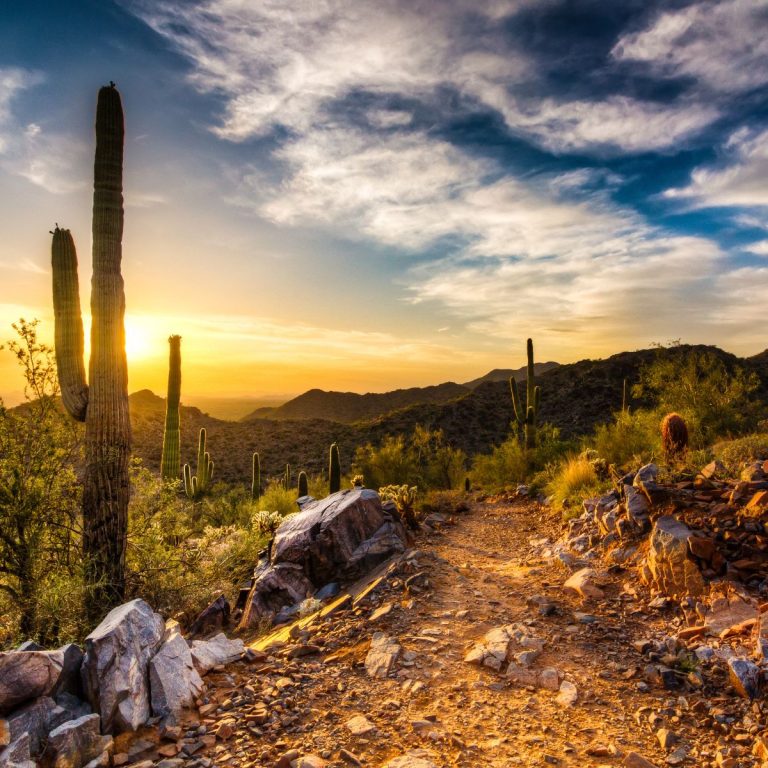
17 Scenic And Wild Arizona Rivers To Explore
Arizona rivers are not what everyone may envision. Their numbers are many, for a desert state with a really varied climate!
We’re from Arizona and have been in nearly every one of the state’s climate zones: to all but the Alpine Tundra, found at two of our highest mountain tops, above 11,000 ft.
We love our Arizona rivers. About 90,373 river miles in AZ! Isn’t that amazing?
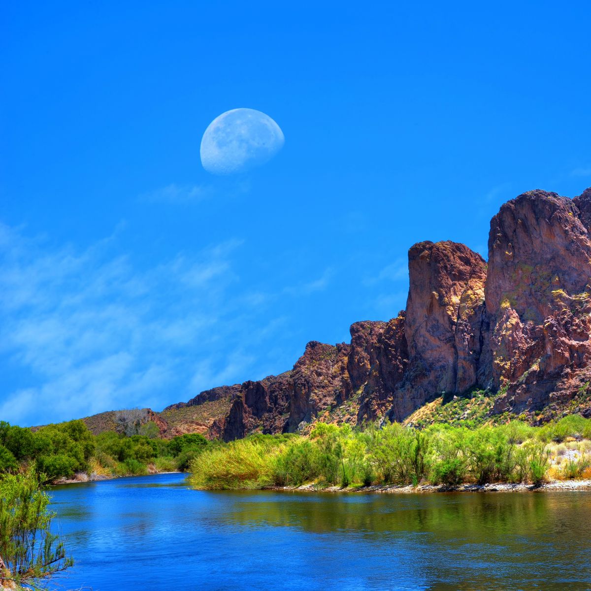
Table of Contents
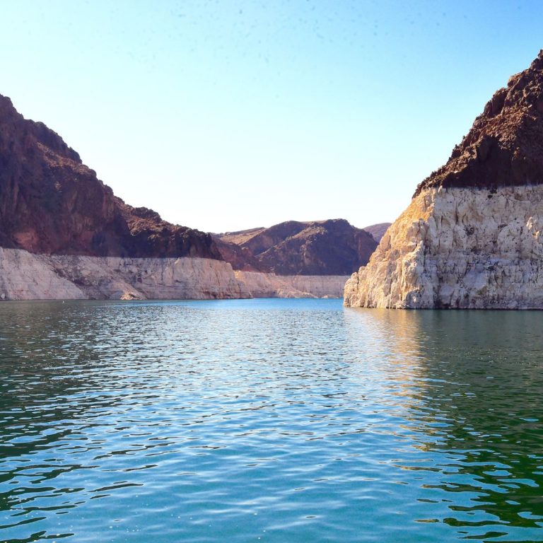
Think about this – If it weren’t for rivers, we wouldn’t have many (maybe most) of the southwestern U.S. lakes.
Arizona Rivers and Lakes are related, actually depending on each other. But we’re worried about many of them, for their habitat and resources for recreation.
I’m sure you know of the Colorado River. Maybe you know about the Salt River. But have you heard of the San Pedro River? Or the Black River, or the Gila River? They’re in different areas of Arizona. Flowing through varied climate zones, meeting various challenges.
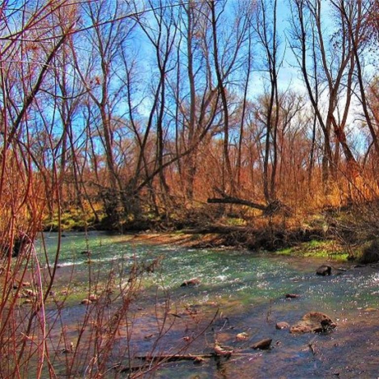
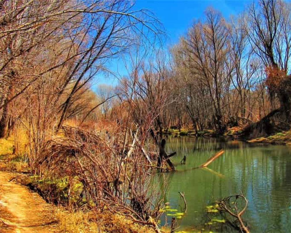
This is the Rillito River in Tucson, the town where we live:
No, it doesn’t usually look this way! Our Monsoon Season of 2021 was exceptional. So, how does this river usually look? Well, you’ll find out here!
Let’s go on a virtual trip to the best Arizona Rivers. See where they are, how their water arises, where it goes. Maybe you’ll graduate from the virtual to the real world. And then help them out, too!
How to Figure Out a River? Major? Small? Stream? Tributary?
Numbered tree branching with trunk having a higher number and more outer limbs with lower numbers to demonstrate evaluating classifying river tributaries.
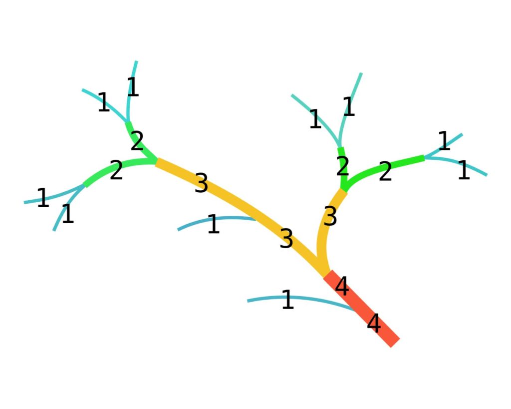
What is a major river? An algorithm for figuring this out was first created in 1952 by geoscientist Arthur Newell Strahler.
It’s like a branching tree. Called the Strahler Stream Order, classifying rivers by their tributaries. Higher classification means a more major river, because of more tributaries. Contributing to its water flow.
Another method expanded this: Shreve. Giving additive credit when tributaries link to each other.
Another way is water flow.
For instance, consistent water flow higher than 163 cu.ft./second defines a major river. Typically that’s Arizona rivers on which you can boat or raft1.
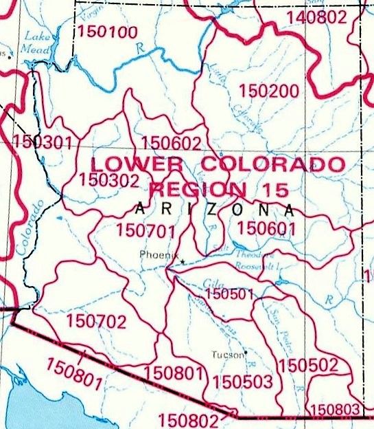
Another type of analysis is Watersheds, using Hydrologic Units. Most of Arizona is in the Lower Colorado Regional Watershed. The codes have digits reflecting local waters: rainfall, recharge, snow-melt, etc. contributing to drainage into individual rivers.
According to the Center for American Progress, 92% of major Arizona Rivers have been altered for farming, recreation, utility/drinking water, etc.2
River protection & help is very important. They assist local economies & add to life quality.
Arizona Major Rivers
What are those major Arizona rivers?
1. Colorado River
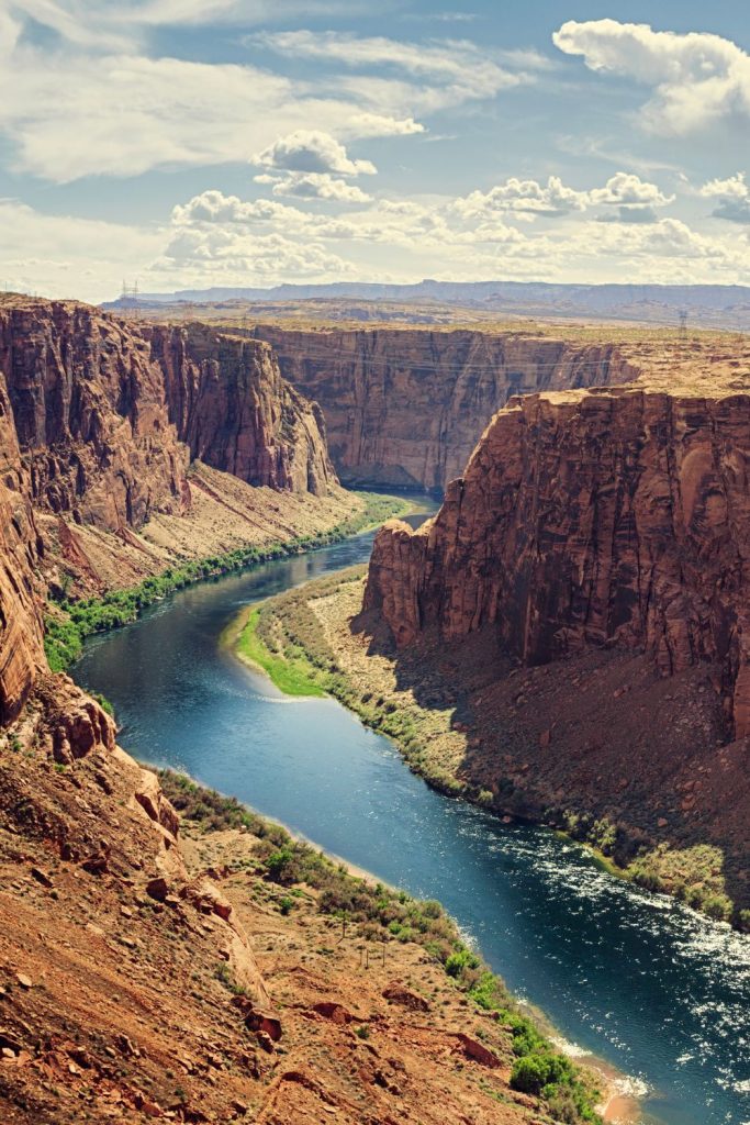
Named for the state, the headwaters are amidst the Green River in Wyoming. Length totals about 1700 miles, 1450 in AZ.
- Very popular and known throughout the world for boating/rafting, fishing, camping and hiking areas, birding and more.4
- Seven river basin states recognized its importance. In 1922 the Colorado River Compact was signed for water management amongst them. In 1963 Native Americans, ignored in that pact, were ensured their water rights.5
- Efforts are still on, such as 2014’s successful pilot program promoting discretional usage cutbacks at Lake Meade and Lake Powell.6 This famed Arizona river is getting more pressure over time.
2. Salt River
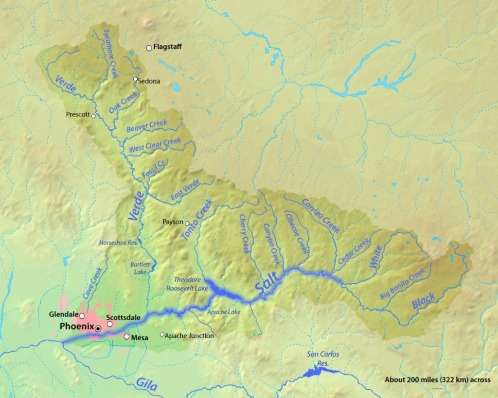
With a median flow of 685.68 cu.ft/sec., this popular river is valuable for many reasons. Although a 200-mile major Arizona river, it’s a tributary of the Gila River.
But kind of a misnomer, as it’s dry when reaching Phoenix. Except for the created Tempe Town Lake.
Many upstream contributors to its flow, including White Mountain’s Black & White River headwaters. The Salt River Canyon is reminiscent of a mini Grand Canyon. Quite impressive!
Four dams along its length create reservoirs: Saguaro, Canyon & Apache Lakes. Plus the largest, Roosevelt Lake.
Recreation includes tubing, rafting/kayaking, fishing, swimming, etc.
3. Gila River
Consider its two parts. Headwaters in New Mexico, then getting to the state line, as an Arizona river its flow averages 207 cu.ft/sec.
Going through rural southeastern AZ, entering Gila Box National Conservation Area. Water streams in from San Francisco & Blue Rivers, then Eagle & Bonita Creeks.
Leaving the NCA, San Carlos River supplies some flow, for an Upper Gila basin average of 1,371 cu.ft/sec.
Entering the lower basin, it intermittently gets water from tributaries like Agua Fria & Hassayampa Rivers. From this, the total Lower Gila flow at the Colorado River near Yuma is almost 1,496 cu.ft/sec.
4. Virgin River
Headwaters in Utah. Only coursing through Arizona’s far Northwest corner, it’s a Colorado River tributary, via entering Lake Meade. Where its volume averages 271.6 cu.ft/sec.
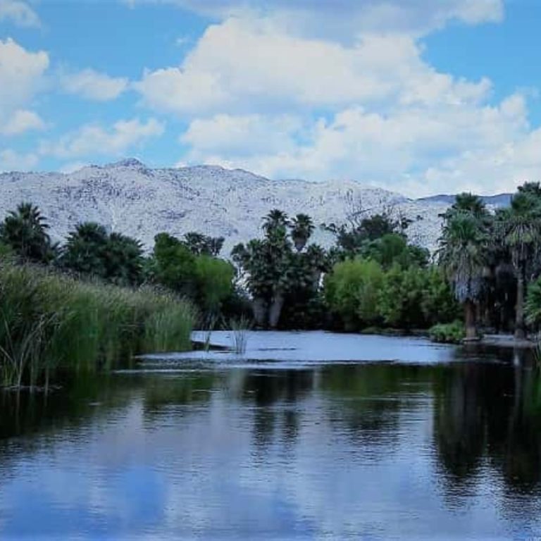
5. Verde River
Fabulous natural river in upstream areas. Essentially between Perkinsville & Packard Ranch, then from Childs until you get to Horseshoe Reservoir. 3
This Arizona river has strong tributaries like Beaver, Oak & Granite Creeks advancing flow means to nearly 1535 cu.ft/sec.
Downstream finds dams creating Horseshoe & Bartlett Lake.
Smaller Arizona Rivers
6. Little Colorado River
Sourced at Mt. Baldy’s Wilderness, not long before meeting up with dams. Has an unusual northwest flow. What little’s left empties into the much bigger Arizona River: the Colorado.
Flowing pretty well in the high county, it’s a trickle when arriving at the Navajo Nation.
- Winter storms or large summer Arizona Monsoon events get it running.
- Then the iconic Grand Falls revives. Nicknamed Chocolate Falls! Dark brown water flows over the 181+ foot riverbed cliff at about 1500 gal/min.4,5 Coloring from rushing water picking up the riverbed’s red sand sediment.
7. Bill Williams River
Totaling almost 449 gal/min. primarily from upstream of the Big Sandy River & its Burro Creek tributary.
- Trout Creek meets another branch of Big Sandy, both adding intermittent flow.
- Bill Williams ends, flowing into Lake Havasu, North of Parker Strip.
8. Black River
Headwaters at SU Knolls springs, White Mountains, adjacent to Crescent Lake.
- Popular fishing river.
- 42 cu.ft/sec. output before confluence with White River, both as Salt River tributaries.
9. White River
White Mountain headwaters east of 11,000′ Mt. Warren.
- Rock Creek merges with the river’s East Fork. Output 12 cu.ft/sec. between the two.
- When mingling with the Black, surge averages 61 cu.ft/sec.
10. Eagle Creek
Headwaters east of Freezeout Mountain as Dry Prong Creek.
- East Eagle Creek joins near Robinson Mesa, dropping east.
- After Willow & Cienega Creek babble in, mean 59.6 cu.ft/sec., then meets the Gila.
11. Hassayampa River
Headwaters at 7400′ in Prescott Forest, adjacent to Dandrea Trail, Southwest of Mt. Davis.
- Looping to generally southward, through Wickenburg, often dry by then. Following US60 before veering westward until merging with the Gila.
- Average output 72 cu.ft/sec.
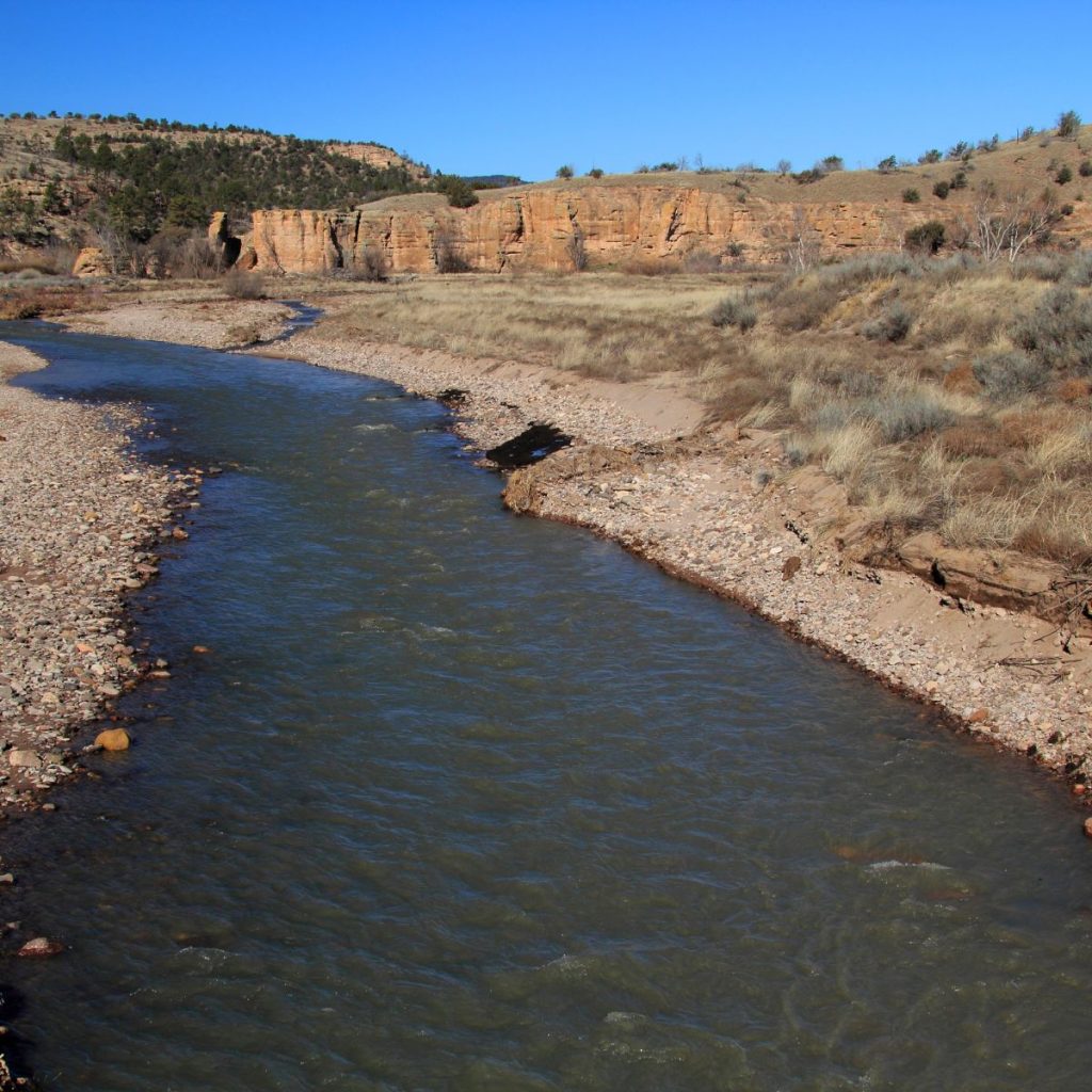
12. San Pedro River
Lengthy tributary to the Gila, unusual Northward flow.
- Headwaters almost 4700′ up, near Mexican border, east of Coronado Peak. Before drying up in St. David, its mean issue is 38.1 cu.ft/sec. Savor it
13. Santa Cruz River
Once a much more mighty river, its cascade has immensely changed.
- Sourced above 5000′ at Meadow Valley Tank in Coronado National Forest, south of Sonoita. Southward into similar mountainous region of Mexico. Arcing westward then reentering the U.S. east of Nogales AZ, beginning its northward course. Perennial natural burble then averages 3.66 cu.ft/sec.
- Crossing Hwy.82 west of Nogales International Airport it begins paralleling I-19’s eastside, south of Rio Rico. When arriving at Tubac, mean flow is 16 cu.ft/sec.
- Continuing north, elevation lower, coming into Sonoran Desert environment. At Green Valley it’s dry.
- The riverbed jogs west of I-19 northeast of Tohono O’odham Reservation, into Tucson. Where now paralleling west of I-10.
- It becomes a sewage waste-water treatment river. The recharge system begins west of Prince Road’s western end. Creating Sweetwater Wetlands & also a river spurt totaling 77 cu.ft/sec. before Marana’s Pima/Pinal County line.
- Soon after it dries up ending in the desert in Eloy.
Arizona’s Smallest Rivers
Consistently flowing small rivers and streams in Arizona are valuable tributaries to larger Arizona rivers. Quite a few notable ones course throughout the state. As primary, secondary, or even tertiary tributaries, they contribute significant water flow into larger rivers.
Some of them are in more mountainous areas, like Show Low Creek, Chevelon Creek, and Granite Creek.
You may have heard of the very popular Oak Creek, which runs through a beautiful canyon. And then through Sedona Arizona. All the gorgeous red rock scenery.
We always love driving through, and staying in Oak Creek Canyon!
There’s a wonderful state park, and scenic places to pitch your tent, or pull in your small RV, off the grid. A little too rough? Find cabin rentals all along the route, as well!
Oak Creek – Sedona Area Lodging
Many other small Arizona rivers traverse desert areas. Some of these are Cave Creek, Agua Fria River, Tonto Creek, much of Sabino Creek, and Cienega Creek.
What are all these smaller Arizona rivers and streams contributing to larger river cascades? Most do so intermittently.
On some maps, many more can be found that are named, including those that are dry washes, or arroyos. These have sporadic currents, contributing water during heavy winter rains, or monsoon storms.
Their dry stream beds support wildlife and plant life, though. So even without steadily running outpours, their riparian river/streamside areas are very valuable to the environment.
Arizona Scenic/Wild Rivers & National Conservation Lands
Sadly, of all Arizona rivers, only 57.3 miles are under 1968’s National Wild and Scenic Rivers System’s Act. The criteria says because a river has “outstandingly remarkable scenic, recreational, geologic, fish and wildlife, historic, cultural or other similar values, [it] shall be preserved in free-flowing condition.”7
Why? So the river itself, and its surroundings, will be around interminably as a treasure for all. Congress or the Secretary of the Interior can designate rivers. Even portions of a river, optionally including tributaries. Classifying them as wild, recreational, or scenic.7 Which Arizona rivers have Been Assigned under this act?
14. Verde River
Both a scenic and wild river
- Wild Arizona river area, 22.2 miles. Covering from the north boundary of Mazatzal Wilderness south to convergence with Red Creek.
- The scenic river section begins North of Beasley Flat in Prescott National Forest, 18.3 miles. The southern boundary is the perimeter of Mazatzal Wilderness.7
15. Fossil Creek
Amazing continuous stream for its nearly 19,300 gal/min. travertine flow, originating from artesian springs.
- Its wild section goes 9.3 miles, then recreational for 7.5 miles.7
- Has a very popular swimming hole within Coconino National Forest. Doesn’t mean it’s easy to get to! But people believe it’s Worth It.
National Conservation Area Arizona Rivers
Similar to the Wild & Scenic Rivers Act, National Conservation Areas specify public lands for protection, conservation, recreation, enhancement & resource management when appropriated by Congress. Managed by the Bureau of Land Management (BLM).
16. Gila River8,9
Year-round kayaking (summer inflatable) in this National Conservation Area River in Gila Box NCA.
Over 20 miles of the Gila are designated here, within Four riparian zones.
- In winter higher water levels allow rafting or canoeing.
- Other activities: camping, fishing, shoreline wading, birding, and picnicking.
- Great place to spot bighorn sheep atop cliffs.
17. San Pedro River
Flowing north from the international border, year-round through about 40 miles of Riparian NCA.8 Not long afterward, around St. David, it dries up; surging intermittently with rain run-off.
- We’re members of Friends of the San Pedro. We’re concerned with developing county areas placing pressure on the river.
- They sponsor weekly guided nature & history walks, which we highly recommend. (Membership not required.)
- River exploration is best from Fairbank AZ, or the San Pedro House, off Hwy.90 SE of Sierra Vista.
- A well adjacent to the San Pedro River was tested for water table levels. It reflected related groundwater pressures. It can be seen the water table is lowering over time. Apparently from pressures in the area requiring more & more groundwater.
References
- 1 Harrison-Atlas, D., Theobald, D.M., Dickson, B.G., Landau, V. & Leinwand, I. (n.d.) The Disappearing West. Chapter 1: The Big Picture. Center for American Progress.
- 2 : Harrison-Atlas, D., Theobald, D.M., Dickson, B.G., Landau, V. & Leinwand, I. (2017). Description of the approach, data, and analytical methods used to evaluate river systems in the western U.S. Truckee, CA: Conservation Science Partners.
- 3 Brown, David E. (1985). Arizona wetlands and waterfowl. Tucson, AZ: University of Arizona Press.
- 4 Fradkin, P.L. (1981). A river no more. Tucson, AZ: University of Arizona Press.
- 5 Atkins, W.A. (2018, May 8). Colorado River Basin. Water: Science and Issues. Encyclopedia.com
- 6 Richards, R. (2018, April 9). Restoring Balance: Healthier rivers and secure water supplies in the American west. Center for American Progress.
- 7 National Wild & Scenic Rivers System (n.d.) Arizona. Nationwide Rivers Inventory.
- 8 Bureau of Land Management (n.d.). Arizona national conservation lands. U.S. Department of the Interior.
- 9 BLM/AZ/GI-01/010 (2006, Oct.). Let’s explore the Gila Box. Brochure/Map. National Landscape Conservation System, Bureau of Land Management.
- 10 NWIS-Web for the Arizona Water Science Center (2021, Dec. 14). Current Conditions for Arizona: Streamflow. USGS.